


Voting District 3053, Bexar County, Texas
About
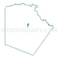
Outline

Summary
| Unique Area Identifier | 670733 |
| Name | Voting District 3053 |
| County | Bexar County |
| State | Texas |
| Area (square miles) | 1.51 |
| Land Area (square miles) | 1.49 |
| Water Area (square miles) | 0.02 |
| % of Land Area | 98.66 |
| % of Water Area | 1.34 |
| Latitude of the Internal Point | 29.49875000 |
| Longtitude of the Internal Point | -98.47272270 |
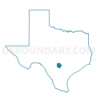
Maps

Graphs
Select a template below for downloading or customizing gragh for Voting District 3053, Bexar County, Texas


Neighbors
Neighoring Voting District (by Name) Neighboring Voting District on the Map
- Voting District 2038, Bexar County, TX
- Voting District 2054, Bexar County, TX
- Voting District 2092, Bexar County, TX
- Voting District 2094, Bexar County, TX
- Voting District 2121, Bexar County, TX
- Voting District 2136, Bexar County, TX
- Voting District 3018, Bexar County, TX
- Voting District 3020, Bexar County, TX
- Voting District 3025, Bexar County, TX
- Voting District 3026, Bexar County, TX
- Voting District 3027, Bexar County, TX
- Voting District 3046, Bexar County, TX
- Voting District 3057, Bexar County, TX
- Voting District 3135, Bexar County, TX
Top 10 Neighboring County Subdivision (by Population) Neighboring County Subdivision on the Map
Top 10 Neighboring Place (by Population) Neighboring Place on the Map
Top 10 Neighboring Unified School District (by Population) Neighboring Unified School District on the Map
- North East Independent School District, TX (396,578)
- Alamo Heights Independent School District, TX (28,854)
Top 10 Neighboring State Legislative District Lower Chamber (by Population) Neighboring State Legislative District Lower Chamber on the Map
- State House District 120, TX (163,187)
- State House District 121, TX (158,873)
- State House District 123, TX (132,442)
Top 10 Neighboring State Legislative District Upper Chamber (by Population) Neighboring State Legislative District Upper Chamber on the Map
Top 10 Neighboring 111th Congressional District (by Population) Neighboring 111th Congressional District on the Map
Top 10 Neighboring Census Tract (by Population) Neighboring Census Tract on the Map
- Census Tract 1203, Bexar County, TX (7,031)
- Census Tract 1207.01, Bexar County, TX (5,326)
- Census Tract 1920, Bexar County, TX (5,244)
- Census Tract 1207.02, Bexar County, TX (4,477)
- Census Tract 1909.02, Bexar County, TX (3,783)
- Census Tract 1907, Bexar County, TX (3,060)
- Census Tract 1908, Bexar County, TX (2,237)